I will create interactive webgis maps and web mapping applications

A
aayushchand123
A
aayushchand123
Aayush C

About this gig

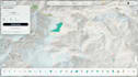
Need an interactive web map to visualize your geographic data? I can build custom WebGIS applications that make your spatial data easy to explore and understand.


My services include:

  • Interactive web maps using MapLibre GL JS, Leaflet, Openlayers
  • Displaying GeoJSON and other supported geospatial data
  • Custom map styles, colors, labels, and symbols
  • Interactive layers, markers, and popups
  • Layer switching, legends, and map controls
  • Choropleth and thematic maps
  • Environmental and satellite data visualization
  • Vector tile integration
  • Responsive map layouts
  • Deploying maps to platforms such as GitHub Pages or Cloudflare Pages


What you'll receive:

  • An interactive web map tailored to your needs
  • Organized source code
  • Custom styling and map interactions
  • Basic setup and deployment


I can help turn your GIS datasets into clear, engaging web maps for research, portfolios, reports, and public-facing projects.


Please contact me before ordering to discuss your data, required features, and project scope. Complex backends, databases, user authentication, and advanced functionality may require a custom offer.

Respect third-party rights

Please be aware that it is against Fiverr's policies for sellers to include themes, templates, or any other elements that infringe third-party rights or applicable laws in the delivered work. Read more about in our Guide to Responsible Digital Creation.

Get to know Aayush C

Aayush C

Geospatial Analysis, Cartography, WebGIS

  • FromNepal
  • Member sinceFeb 2026
  • Avg. response time1 hour
  • Languages

    English, Nepali, Hindi
I’m a Geomatics Engineering graduate and Geospatial Analyst who helps turn complex spatial data into clean, reliable datasets, clear analyses, and visually engaging maps. I work best with: • GIS & Spatial Analysis – QGIS, Python • Remote Sensing – Google Earth Engine and satellite data • Cartography & Map Design – modern, publication-ready maps • Geospatial ETL – data extraction, cleaning, transformation, and automation • OpenStreetMap & data quality improvement.

My Portfolio