Browse categories
Explore
Fiverr Pro
English
$
USD

Are you looking for professional hydrological modeling and remote sensing analysis to support your research, environmental study, or hazard mapping project?
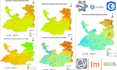
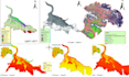
I specialize in providing expert services using industry-standard tools like HEC-RAS, HEC-HMS, SWAT, and advanced GIS and remote sensing techniques for environmental and disaster risk assessment.
My services include:
With 7 years of experience in academic research, development projects, and freelance GIS modeling, I deliver accurate, visually compelling, and scientifically validated outputs tailored to your needs.
GIS and Remote Sensing Specialist
Languages


