Browse categories
Explore
Fiverr Pro
English
$
USD


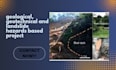
I provide professional geological, geotechnical, and landslide hazard assessment support for construction, infrastructure, and environmental projects. My services help clients understand ground conditions, identify potential risks, and support informed project planning.
My services include:
Whether you are working on residential developments, road construction, foundation projects, or land-use planning, I focus on accurate data interpretation, clear technical documentation, and practical project-specific results.
I tailor my work to your project scope, available data, and required deliverables. Please contact me before ordering to discuss your requirements and ensure the service matches your needs.
Note: Assessments requiring licensed professional engineering or geological approval must be reviewed and approved by a qualified professional where applicable.
Please inform the freelancer of any preferences or concerns regarding the use of AI tools in the completion and/or delivery of your order.
provide soil classification soil profile drafting boring log digitization
Languages
What geological and geotechnical services do you provide?
I provide geological data analysis, soil classification, geotechnical data interpretation, slope stability analysis support, landslide hazard assessment, GIS mapping, and technical report preparation based on your project requirements.
What information do you need to start my project?
Please provide your project location, project scope, available geological or geotechnical reports, soil investigation data, site maps, topographic information, and any specific requirements or preferred deliverables.
Can you prepare customized landslide hazard and geotechnical reports?
Yes. I can prepare project-specific technical documentation, hazard mapping, and analysis support using the available data. The scope and accuracy depend on the information provided. Reports requiring licensed professional approval must be reviewed by a qualified professional where applicable.
