Browse categories
Explore
Fiverr Pro
English
$
USD

Level 1


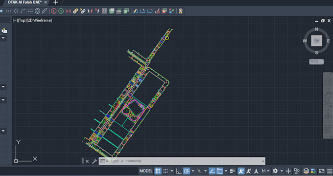
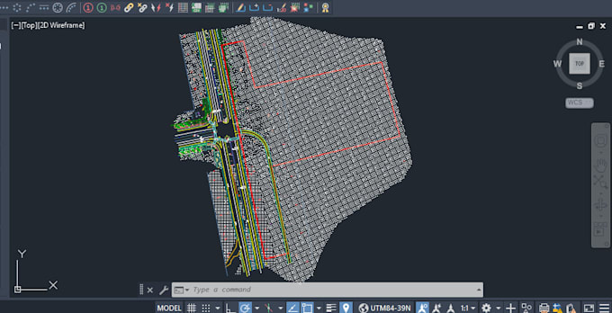
Are you looking for a professional Civil 3D expert to convert your LiDAR or point cloud (.LAS / .LAZ) data into accurate topographic survey drawings? You are in the right place.
I specialize in processing small to large LiDAR datasets and delivering engineering-grade Civil 3D topographic plans with precision and clean drafting standards.
My services include:
TIN surface creation in Civil 3D
1ft / 2ft / 5ft contour generation
Breakline extraction
Road edges and drainage feature modeling
Clean, properly layered DWG files
DOT-level PS&E formatted drawings
Survey-ready PDF sheets
I work with drone LiDAR data, aerial mapping datasets, ground survey point clouds, and large LAS files. Every project is handled with a structured workflow to ensure accuracy and professional results.
Why choose me?
Accurate engineering approach
Organized Civil 3D surface management
Clean layering and drafting standards
Clear communication
Reliable and timely delivery
Please contact me before placing an order to discuss dataset size, scope, and requirements.
Fiverr does not screen freelancers in this category. Please verify qualifications and discuss requirements with the freelancer before ordering, including any preferences regarding the use of AI tools.
Professional AutoCAD Survey Quantity Solutions
Level 1
Languages
Can you handle large LAS files?
Yes, I specialize in processing large LiDAR datasets efficiently.
Do you provide DOT-level PS&E drawings?
Yes, I can prepare plans according to DOT drafting standards.
What software do you use?
Autodesk Civil 3D, AutoCad Global Mapper (Latest version).
Can you extract breaklines and features?
Yes, road edges, curbs, drainage, and terrain features.
How fast can you deliver the drawings?
Delivery depends on drawing complexity and quantity. Urgent delivery is available—please message me before ordering.
Do you provide revisions?
Yes. Revisions are included according to the selected package to ensure your satisfaction.
Do you offer any customer satisfaction guarantee? How do you handle revisions or issues?
Yes, absolutely. I provide a 100% customer satisfaction guarantee. If there is any issue, mismatch, or adjustment needed in the drawings, I offer free revisions (as per package) until you are fully satisfied. I always communicate clearly, review client feedback carefully, and resolve any issue quick
| (1) | ||
| (0) | ||
| (0) | ||
| (0) | ||
| (0) |
candrone

Canada
Understood the request, delivered promptly, and was very communicative. I would work with them on other projects. Pricing was also very reasonable for the timeline I requested.
$200-$400
Price
3 days
Duration
| (1) | ||
| (0) | ||
| (0) | ||
| (0) | ||
| (0) |
candrone
Canada
Understood the request, delivered promptly, and was very communicative. I would work with them on other projects. Pricing was also very reasonable for the timeline I requested.
$200-$400
Price
3 days
Duration