Browse categories
English
$
USD
Connect to your AI

Need a clear, professional map for a report, a thesis, a project or a presentation?
I am a Geomatics and GIS engineering student and I create clean, accurate maps in ArcGIS Pro or QGIS from your data (or from open data like OpenStreetMap, satellite imagery and official datasets).
Types of maps:
- Location and site maps
- Thematic maps (population, land use, risk, environment)
- Choropleth, heat and density maps
- Infrastructure, network and project maps
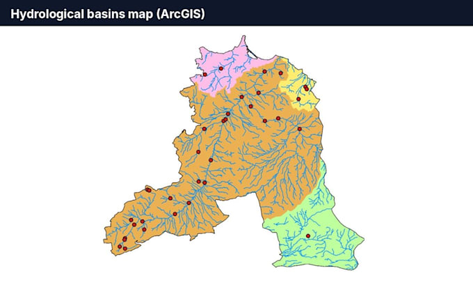
- Topographic and hydrology maps (watersheds, slopes, DEM)
Every map includes:
- Proper layout: title, legend, scale bar, north arrow, sources
- Correct coordinate system
- High-resolution PNG and PDF export
- Source files on request (APRX / QGZ, layers)
Please message me before ordering with your data (Shapefile, GeoPackage, GeoJSON, KML, Excel with coordinates...) and an example of the style you like.
GIS Software Engineer
Languages
What data do you need from me?
Your GIS files (Shapefile, GeoPackage, GeoJSON, KML) or an Excel/CSV with coordinates. If you have no data, I can use open data sources for your area.
Will I receive the project source files?
Standard and Premium include the ArcGIS Pro or QGIS project and layers, so you can edit the maps later. Basic includes high-resolution PNG and PDF exports.
Can the map follow my report or company style?
Yes. Send me your colors, logo, page size (A4, A3...) or an example, and I will match the layout and language (English or French).