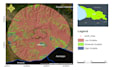
Are you looking for a professional GIS expert for GIS site selection, land suitability analysis, or spatial analysis? With over 5 years of experience in GIS, Remote Sensing, and Engineering Geology, I deliver accurate, high-quality GIS solutions using ArcGIS, QGIS, AHP, MCDA, and Weighted Overlay techniques.
Services I Offer
- GIS Site Selection
- Land Suitability Analysis
- AHP & MCDA Analysis
- Weighted Overlay
- Spatial Analysis
- Raster & Vector Processing
- Buffer, Overlay & Proximity Analysis
- Environmental & Geological Mapping
- Solar, Wind & Landfill Site Selection
- Groundwater Potential Mapping
- Custom GIS Projects
Deliverables
- PDF, PNG & JPG Maps
- ArcGIS Project Files
- Shapefiles & GeoTIFFs
- Professional Maps with Legend & Scale
- Methodology Summary (on request)
- Please contact me before placing an order to discuss your project requirements and ensure the best GIS solution.