Browse categories
Explore
Fiverr Pro
English
$
USD


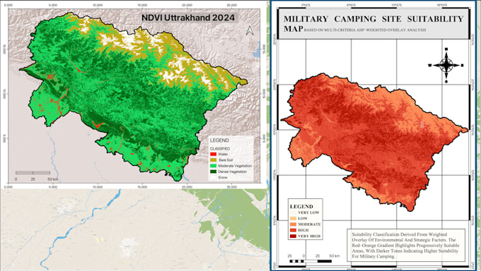
I will create professional vegetation and climate index maps (NDVI, SAVI, LST, NDWI) and perform Land Use/Land Cover (LULC) classification with temporal change detection using satellite data (Landsat, Sentinel, MODIS). My services range from simple vegetation analysis to multi-year spatio-temporal studies with detailed reports. Youll receive accurate, publication-ready maps, shapefiles, and datasets tailored for research, planning, or environmental monitoring.
GIS analyst and specialist
Languages
What outputs will I receive?
You’ll get publication-ready maps (PDF/PNG), GIS-compatible layers (GeoTIFF, Shapefile), and a summary report. Higher packages include detailed analysis and presentation slides.
Do you provide custom vegetation/climate indices not listed?
Absolutely. I can calculate custom indices (e.g., EVI, NDBI, NDMI) based on your research or project requirements.
Can you align the work with my thesis/research publication standards?
Yes, I have academic research experience and can deliver maps, data, and reports in formats suitable for journal publication or academic submission.