Browse categories
Explore
Fiverr Pro
English
$
USD

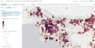
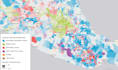

Do you need to convert or fix your GIS data quickly and accurately?
You're in the right place.
I provide professional GIS data conversion, cleaning, and formatting services to ensure your data is accurate, usable, and ready for your project.
Services I offer:
Why choose me?
Kindly contact me before ordering for complex datasets.
GIS Specialist
Languages
What file formats do you support?
I work with Shapefile, GeoJSON, KML, CSV, GPX, and other common GIS formats. If you have a different format, feel free to ask.
Can you fix corrupted or invalid GIS data?
Yes. I can repair common issues such as invalid geometries, missing attributes, projection errors, and formatting problems.
Do you handle coordinate system (CRS) conversions?
Absolutely. I can convert your data to any required coordinate system (WGS84, UTM, etc.) accurately.
Is my data safe and confidential?
Yes. Your data is handled professionally and kept strictly confidential.
Can you prepare data for web mapping (Leaflet/Mapbox)?
Yes. I optimize and format GIS data for seamless use in web mapping applications.
What if my dataset is large or complex?
For large or complex datasets, please contact me first so I can review the scope and provide a custom solution.
Do you provide source/output files?
Yes. You will receive the final converted and cleaned files in your requested format.


