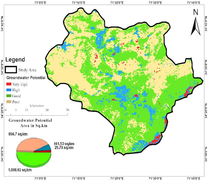
I will map groundwater potential zones using gis, rs, and mif

A
akmal8032
A
akmal8032
Akmal Sardar

About this gig

Need a professional Groundwater Potential Zone (GWPZ) Map for your research, project, or environmental study? I provide accurate GIS and Remote Sensing-based groundwater potential mapping using industry-standard techniques.

My services include:

  • Groundwater Potential Zone Mapping
  • Groundwater Recharge Zone Mapping
  • GIS Spatial Analysis
  • Remote Sensing Analysis
  • Weighted Overlay, AHP, and MIF Modeling
  • Hydrological and Hydrogeological Mapping
  • High-quality maps with legends, layouts, and reports

I use ArcGIS, ArcGIS Pro, QGIS, Google Earth Engine, and satellite data to produce reliable and visually appealing maps tailored to your project requirements.

Whether you're a researcher, student, consultant, NGO, or government organization, I will deliver accurate, high-quality results with timely communication and on-time delivery.

Why choose me?

  • Professional GIS expertise
  • Accurate spatial analysis
  • High-resolution map outputs
  • Fast delivery
  • Unlimited revisions until you're satisfied

Feel free to contact me before placing an order so we can discuss your project requirements.

Get to know Akmal Sardar

Akmal Sardar

GIS Analyst and Hydrologist

5.0(4)
  • FromPakistan
  • Member sinceJul 2022
  • Last delivery2 weeks
  • Languages

    Urdu, English
GIS Professional and Cartographer with a Master's in Geospatial Sciences, passionate about solving real-world challenges through precise geo-mapping and insightful data visualization. I offer Georeferencing, Geocoding/Reverse Geocoding, Raster-to-vector Digitization, Satellite Image Processing, and Custom Mapping Solutions for research or detailed Project needs. Let's transform your data into actionable insights and compelling maps. Contact me today.

My Portfolio

Related tags