Browse categories
English
$
USD
Connect to your AI

Hello! I'm Aksheyta, a GIS and Remote Sensing Specialist with 10 years of professional experience in geospatial data processing, mapping and spatial analysis.
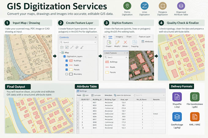
I provide accurate GIS digitization and data preparation services using ArcGIS Pro helping you convert maps, drawings and spatial references into clean, organised GIS datasets.
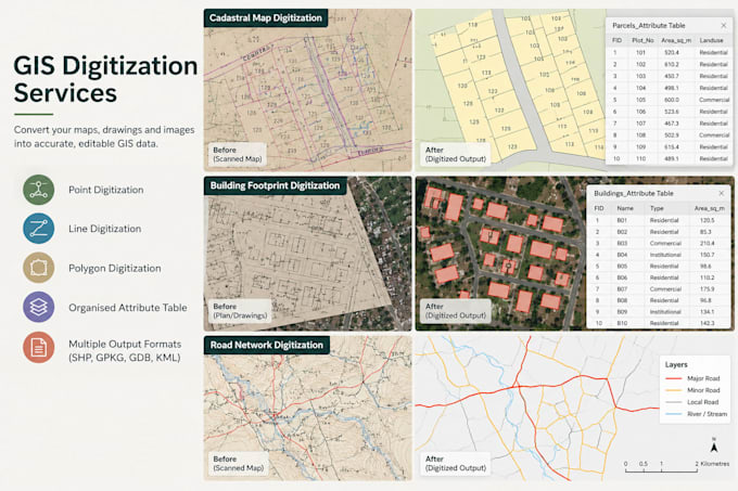
My Services
What You'll Receive
I work with environmental, urban planning, infrastructure, research and general mapping datasets.
Please message me before ordering if your project involves complex maps, large datasets, multiple layers or extensive georeferencing. This will help me confirm the scope, accuracy requirements and delivery time.
Let's work together!
GIS Professional, GIS Consultant, Spatial Analysis , ArcGIS , Web Dasboard
Languages
What files do you need to start?
Please share your source map, PDF, image, CAD drawing or existing GIS data, along with the area of interest and required output format.
Can you digitize scanned maps and PDFs?
Yes. I can digitize suitable scanned maps and PDFs. Georeferencing may be required before digitization, depending on the source.
Which output formats can you provide?
Depending on the project, I can provide Shapefile, GeoPackage, File Geodatabase, KML/KMZ and other compatible formats.
Will my data be survey-grade accurate?
Accuracy depends on the original source, scale, resolution, coordinate information and control points. GIS digitization does not replace a professional land survey.