Browse categories
Explore
Fiverr Pro
English
$
USD


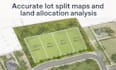
Maximize your property value with an accurate lot split map and land allocation analysis. I draft permit-ready parcel splits, land subdivision maps, and property partition plans for fast municipal zoning approvals.
Dividing a single parcel into multiple lots requires exact measurements and strict adherence to local zoning laws. A poorly drafted partition can delay your real estate development or cause expensive boundary disputes.
I deliver clean, highly accurate AutoCAD layouts that clearly define new property lines, exact lot areas, and required building setbacks. Whether you are splitting a residential lot for resale or allocating land for a family partition, you receive standard-compliant blueprints ready for surveyor review and city submission.
What this gig delivers:
Stop guessing where your new property lines will fall. Secure accurate, execution-ready mapping that makes your subdivision process seamless.
Message me before ordering to discuss your project scope and requirements.
Please inform the freelancer of any preferences or concerns regarding the use of AI tools in the completion and/or delivery of your order.
Professional Engineer
Languages
1. What do I need to provide for you to map out my lot split?
I need an established boundary document to work from. This can be a certified land survey, a county tax map, a legal deed description, or a clear GIS boundary screenshot. Please also include your municipality’s minimum lot size and setback requirements if you know them.
2. How do you calculate the land allocation for irregular parcels?
I utilize geometric balancing within AutoCAD to divide irregularly shaped land. Whether your goal is to divide the property into perfectly equal acreage shares or to maximize the number of road-frontage lots for resale value, the geometry is calculated to the exact square foot.
3. Will my city accept this map for a preliminary lot split application?
Yes. Most city and county planning departments require a preliminary sketch or proposed division plan to review before you pay for an expensive field survey. My drawings include clear line weights, precise dimensions, lot labels, and setback parameters that match municipal submittal standards.
4. Can you accommodate specific local zoning codes like minimum lot widths?
Absolutely. If your zone requires a minimum road frontage (e.g., 50 feet) or a specific minimum lot area (e.g., 0.5 acres), please provide those guidelines. I will design the dividing lines defensively so every single new lot is fully compliant and won't get rejected by the zoning administrator.
5. What if the county planner asks for a minor adjustment to the lot line?
Revisions are part of the development process. If your local county or city planning department reviews the proposed map and requests minor geometric adjustments to meet a specific code, I will update the layout to ensure your map aligns with their feedback.
