Browse categories
Explore
Fiverr Pro
English
$
USD


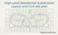
Maximize land development ROI with a high-yield residential subdivision layout and civil site plan. Get permit-ready plot layouts and land subdivision maps optimized for local zoning compliance.
Every layout maximizes buildable lots while respecting setbacks, roads, and easements. Avoid costly permit delays with precise, professional blueprints tailored to your city's requirements.
What this gig delivers:
Whether plotting a multi-lot community or splitting a single parcel, you receive precise, execution-ready files designed in AutoCAD.
Let's optimize your land value. Message me with your land survey before ordering to discuss your project!
Fiverr does not screen freelancers in this category. Please verify qualifications and discuss requirements with the freelancer before ordering, including any preferences regarding the use of AI tools.
Professional Engineer
Languages
1. What information or files do you need from me to start the design?
To ensure absolute accuracy, I require a professional land survey, boundary map, or a Google Earth/GPS location of the property. Additionally, please provide your local municipality's basic zoning requirements (minimum lot sizes, setbacks, and road width requirements) if you have them available.
2. How do you ensure the layout is "high-yield" and maximizes my ROI?
I analyze the property's geometry, topography, and access points to minimize the land wasted on excessive roadways or unusable spacing. By optimizing road alignments and lot configurations, I maximize the total number of buildable lots you can achieve while maintaining full regulatory compliance.
3. Will these subdivision plans be ready for city permit submission?
Yes. All layouts and civil site plans are designed according to standard municipal engineering workflows. They include proper line weights, scaling, setbacks, and dimensions required by city planning and zoning boards for preliminary submittals.
4. Can you design for complex terrains with sharp slopes or hills?
Absolutely. If you provide a topographic survey showing contour lines or elevation data, I will design the road networks and lot layouts using AutoCAD Civil 3D to work naturally with the terrain, minimizing massive earthwork or grading issues down the line.
