Browse categories
Explore
Fiverr Pro
English
$
USD

Level 1


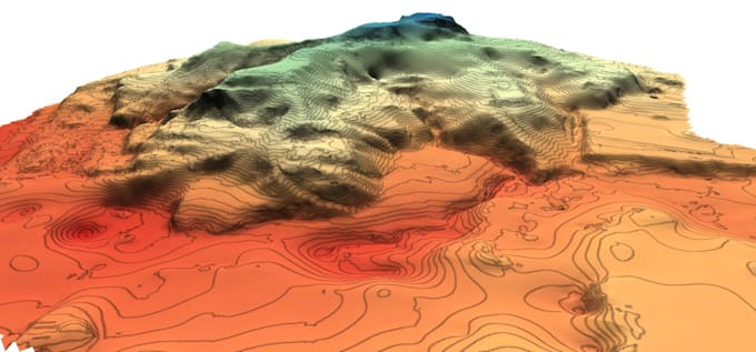
I can do topographical survey with elevation contours, elevation spot points.
I can add infrastructure, houses and etc. I'm working with any input data like LIDAR, DEM, scan data (point cloud). I can use open source data as well.
Please ask for the cost, each project is unique
Please inform the freelancer of any preferences or concerns regarding the use of AI tools in the completion and/or delivery of your order.
GIS and CAD engineer, Architect
Level 1
Languages
| (1) | ||
| (0) | ||
| (0) | ||
| (0) | ||
| (0) |
true_north_tb

Canada
I had a great experience. Simple, Fast and easy.
$200-$400
Price
5 days
Duration
| (1) | ||
| (0) | ||
| (0) | ||
| (0) | ||
| (0) |
true_north_tb
Canada
I had a great experience. Simple, Fast and easy.
$200-$400
Price
5 days
Duration