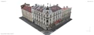
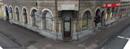
I will scan data to 3d mesh model, unreal engine, lidar, points

A
alex_uav_gis
A
alex_uav_gis
Alex Drone-gis

Level 1

About this gig

3D mesh (digital twin) from scan data, point cloud, lidar, drone photos. I can create texture from photos. Depends on your requirements, I can provide high detailed or optimized model - ready for import to unreal engine

Get to know Alex Drone-gis

Alex Drone-gis

GIS and CAD engineer, Architect

4.7(36)

Level 1

  • FromUnited Arab Emirates
  • Member sinceFeb 2023
  • Avg. response time1 hour
  • Last delivery2 weeks
  • Languages

    English, Russian, French, German
I have 7 years' experience in GIS and CAD. 1) ✔LIDAR, drone, point cloud data processing and analysis 2) ✔Architectural: • 3D modelling • 3D Rendering • Landscape design • BIM modelling 3) ✔CAD: • Topographical plan • Site plan • Floor plan • Elevation plan • Construction plan 4) ✔Laser scanning, terrestrial scanning processing: • Registration • Point cloud analysis • 3D modelling