Browse categories
Explore
Fiverr Pro
English
$
USD


Need to turn your GIS or location data into an interactive web map?
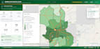
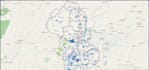
I will create a professional, responsive Web GIS map that allows users to explore your geographic data through an interactive online map.
I work with QGIS, ArcGIS, QGIS2Web, Leaflet, Mapbox and GeoJSON to transform spatial data into clear and user-friendly web maps.
What I can create:
Data I can work with:
GeoJSON, Shapefile, CSV/Excel coordinates, KML and other GIS-compatible spatial data.
I can also help prepare and organize your spatial data in QGIS before creating the web map.
My approach combines GIS analysis, cartography and Web GIS visualization, rather than simply placing points on a basemap.
Please contact me before ordering if your project requires multiple datasets, advanced functionality.
Languages
Can you create a web map from my Shapefile?
Yes. I can process compatible spatial data in QGIS and prepare it for an interactive web map, including conversion to GeoJSON where appropriate.
Can you work with CSV or Excel coordinates?
Yes. If your spreadsheet contains valid latitude/longitude coordinates, I can convert and visualize the data as an interactive map.
Can you create clickable locations?
Yes. Interactive markers can display information such as names, addresses, categories, descriptions and other attribute data you provide.
Can you create maps with multiple layers?
Yes. Standard and Premium packages support multiple spatial layers such as points, lines and polygons.
Can you collect the geographic data for me?
Data collection is available as a separate service depending on the project location and requirements. For Nigeria-based field data collection or research projects, contact me before ordering.
Do you also provide spatial analysis?
Yes. I offer GIS and spatial-analysis services including data preparation, thematic mapping and selected spatial-analysis workflows. Complex analysis should be discussed before ordering.
Can you create maps for Nigeria or other countries?
Yes. I can work with spatial data from Nigeria and other locations, provided the necessary data is available.


