Browse categories
Explore
Fiverr Pro
English
$
USD

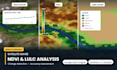
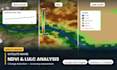
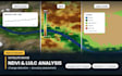
Satellite analysis with the code, the data and the maps - not just a picture.
I use Google Earth Engine, ArcGIS Pro and QGIS on Sentinel-1/2, Landsat 5-9, MODIS, SRTM and ALOS data. My own published work is on glacier change monitoring in the Karakoram, so I handle long time-series and multi-date change detection properly.
ANALYSIS I DELIVER
- NDVI, NDWI, NDBI, EVI, SAVI, NBR and custom indices
- Land use / land cover classification (supervised, unsupervised, random forest) with accuracy assessment and confusion matrix
- Change detection between any two or more dates
- Vegetation, drought, urban growth, water body and glacier monitoring
- Burn severity and flood extent mapping
- Time-series charts and CSV of extracted statistics
YOU RECEIVE
Classified GeoTIFF rasters, shapefiles, area statistics table, publication-ready map figures, the Google Earth Engine script, and a short methodology write-up you can paste into your report or thesis.
TELL ME
Your study area (shapefile or coordinates), the date range, and what decision or claim the analysis has to support. I will confirm data availability before you order - cloud cover and sensor coverage matter.
GIS Pro
Languages
Will you give me the Earth Engine code?
Yes, in Standard and Premium. You get the commented script so you can rerun or extend the analysis yourself.
Can I use this in my thesis or paper?
Yes. I include the methodology, sensor details, date list, accuracy assessment and citations you need for a methods section.
What if my study area is cloudy?
I use cloud masking and median compositing over a window, or switch to Sentinel-1 radar. I will tell you before you order if the imagery cannot support the analysis.


