Browse categories
Explore
Fiverr Pro
English
$
USD


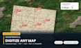

Have a scanned map, a PDF plan, a CAD drawing or a messy spreadsheet that needs to become real GIS data? I will convert it accurately.
WHAT I DO
- Georeference scanned maps, historical maps, PDF plans and satellite screenshots
- Digitize boundaries, parcels, roads, rivers, contours, buildings and geology units
- Convert DWG/DXF to shapefile or geodatabase, with correct coordinate system and layer structure
- Convert KML/KMZ, GeoJSON, GPX, CSV and Excel to shapefile, and back again
- Reproject data between any CRS (WGS84, UTM, national grids)
- Clean topology: fix gaps, overlaps, slivers, invalid geometry and duplicate nodes
- Build the attribute table you actually need, with area, length and IDs calculated
YOU RECEIVE
Shapefile or geopackage, correctly projected, topologically clean, with a populated attribute table, plus a QGIS or ArcGIS project file and a preview map.
SEND ME
Your file (any format) and the coordinate system you need. If you do not know the CRS, I will identify it.
Fast turnaround. Bulk and recurring work priced per file - message me for a quote.
GIS Pro
Languages
My map has no coordinates. Can you still georeference it?
Yes, if it shows recognisable features (roads, rivers, coastline, grid ticks). I match control points against satellite imagery and report the RMS error
Can you handle AutoCAD files with hundreds of layers?
Yes. I map CAD layers to GIS feature classes, set the correct projection and keep your layer naming.
Do you deliver in ArcGIS or QGIS format?
Both. Shapefile and GeoPackage work everywhere; I can also deliver a File Geodatabase or a ready QGIS project.


