Browse categories
Explore
Fiverr Pro
English
$
USD

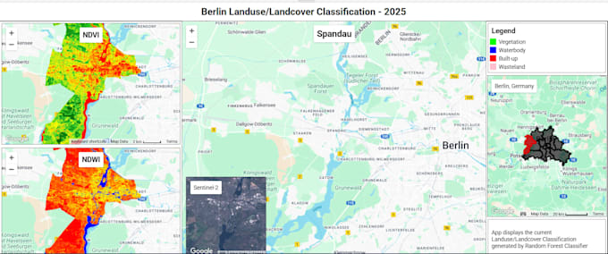
Do you need accurate land use and land cover (LULC) maps for your project, research, or environmental analysis?
I provide professional remote sensing and GIS-based LULC classification using satellite imagery such as Landsat, Sentinel-2, or other datasets. My analysis helps in urban planning, environmental monitoring, agriculture studies, and climate research.
What I offer:
Tools I use:
Use cases:
Geoinformatics Engineer
Languages
Do I provide in german?
Yes, I can also provide maps in german language
