I will create professional gis maps and spatial data analysis

A
andreafortis06
A
andreafortis06
Andrea Fortis

About this gig

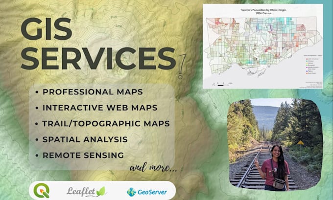
I'm a skilled GIS technician offering high-quality geospatial solutions for your projects. Whether you need custom maps, in-depth spatial analysis, or data visualization, I deliver accurate and professional results.


Services I Offer:

Spatial Analysis:

  • Multi-Criteria Analysis (site suitability, location optimization)
  • Density analysis (kernel density, point density)
  • Hotspot & cluster analysis
  • Remote sensing indices (NDVI, Land Surface Temperature, etc.)

Mapping & Cartography:

  • Professional cartographic maps
  • Topographic maps
  • Trail maps for hiking, biking, and recreation
  • Custom thematic maps


Interactive Web Maps:

  • Fully functional web-based maps using Leaflet.js
  • Custom styling with HTML, CSS, and JavaScript
  • Interactive features (popups, layer controls, search functionality)


Data Services:

  • Digitization of features from imagery or PDFs
  • Geocoding (address to coordinates)
  • Geospatial database creation


Please contact me before placing your order to discuss your project requirements and ensure I can deliver exactly what you need!

Get to know Andrea Fortis

Andrea Fortis

GIS Technician

  • FromCanada
  • Member sinceSep 2022
  • Languages

    English, Spanish
I’m a Junior GIS Technician and Cartographer skilled in QGIS and other open-source geospatial tools, with training in ArcGIS Pro and ArcGIS Online. Although I am familiar with Esri products, I use QGIS and open-source data for all commercial projects to ensure license compliance. I create precise, accurate, and visually appealing maps, perform spatial analysis, and build interactive web maps using Leaflet, JavaScript, HTML, CSS, GeoServer and other open-source tools. With experience in environmental research, I can deliver professional maps and analyses tailored to your project needs.