Browse categories
Explore
Fiverr Pro
English
$
USD


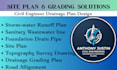
Are you looking for professional civil engineering drawings for permit approval, land development, or construction projects? I will create accurate and detailed site plans, topographic survey drawings, drainage grading plans, and road alignment layouts tailored to your project requirements.
I specialize in civil drafting and engineering support for residential, commercial, and infrastructure projects. Whether you need permit-ready site development drawings, grading concepts, utility layouts, topographic mapping, or roadway alignment plans, I can provide organized and professional CAD drafting services.
What I Offer
Site plan drawings
Topographic survey drafting
Drainage and grading plans
Road alignment layouts
Civil engineering CAD drafting
Utility and infrastructure plans
Permit-ready drawing support
Residential and commercial projects
Why Choose Me
Accurate and detailed CAD drawings
Professional civil drafting support
Fast communication and timely delivery
Clean and organized drawing presentation
Client-focused project assistance
I am committed to delivering reliable and professional civil engineering drawings that support smooth permit approval and construction planning.
Please inform the freelancer of any preferences or concerns regarding the use of AI tools in the completion and/or delivery of your order.
Permit Ready Drainage Grading Plans Designed to Code
Languages
What type of projects do you work on?
I work on residential, commercial, roadway, and land development projects.
Can you create permit-ready site plans?
Yes, I provide professional site and grading plans suitable for permit submission.
What file formats do you deliver?
I can provide PDF, DWG, and other requested CAD file formats.
Do you use topographic survey data?
Yes, I can draft plans based on provided survey and elevation information.
