Welcome to my GIG
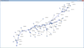
I will do hydrological simulations for a watershed using multiple software.
I can Help You with the Following Work.
- reprocessing
- Data Management
- DEM Reconditioning
- Build wall
- Fill Sink
- Flow Direction
- Flow Accumulation
- Stream Definition
- Stream Segmentation
- Catchment Grid Delineation
- Catchment polygon processing
- Drainage Line Processing
- Adjoint Cachtment Processing
2. Project Setup
- Data Management
- Start New Project
- Generate Project
3. Basin Processing
- Data Management
- Basin Merge
- Subbasin divided by Maximum Area
- River Merge
- Spilt Basin At Confluences
- Import Batch Point
- Delineate Batch Point
4.Characteristics
- Data Management
- River Length
- River Slope
- Basin Slope
- Longest Flowpath
- Basin Centroid
- Centriod Elevation
- Centriodal Logest Flowpath
5. Parameters
- Data Management
- Select HMS Processes
- River Auto Name
- Basin Auto Name
- Grid Cell Processing
- Subbasin Parameters from Raster
- Subbasin Parameters from Features
- Muskingum-Cunge and Kinematic Wave Parameters
- TR55 Flow Path Segments
- TR55 Flow Path Parameters
- TR55 Export to Excel
- CN Lag
6. HMS
- Data Management
- Map to HMS Units
- Check Data
- HMS Schematic
- Toggle Legend
- Add Coordinates
- Prepare Data for Model Export