Browse categories
Explore
Fiverr Pro
English
$
USD


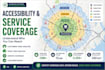
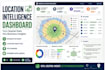

Need more than just a map?
I help businesses, consultants, property developers, tourism operators, and researchers make smarter location-based decisions using GIS, spatial analysis, and location intelligence.
My services include:
Deliverables may include professional maps, interactive web maps, location rankings, suitability assessments, accessibility analysis, Excel/CSV datasets, GIS project files, and executive summary reports.
Whether you need to identify the best business location, evaluate accessibility, analyze service coverage, compare candidate sites, or visualize spatial data, I provide practical GIS solutions tailored to your project requirements.
Please contact me before ordering to discuss your project goals and data requirements.
Web Scraping, GIS Mapping, and Data Automation Expert
Languages
What GIS services do you provide?
I provide GIS mapping, spatial analysis, GeoJSON processing, interactive web mapping, spatial data visualization, and geospatial intelligence workflows.
Which GIS technologies and tools do you use?
I work with QGIS, PostGIS, Python, FastAPI, GeoJSON, Mapbox GL JS, and modern GIS automation and visualization technologies.
Can you build interactive web maps?
Yes. I can develop interactive web GIS interfaces with map visualization, spatial filtering, GeoJSON integration, and business-ready geographic analytics.
What file formats can you deliver?
Deliverables may include GeoJSON, CSV, Excel, spatial datasets, interactive maps, API-ready outputs, and GIS-compatible structured data.
Can you process large-scale geospatial datasets?
Yes. The workflows are designed for scalable spatial data processing, structured analytics, and large-scale GIS intelligence projects.
What data can you analyze?
Business locations, customers, competitors, properties, roads, services, tourism sites, demographics, and spatial datasets.
Can you use my Excel or CSV file?
Yes. I can analyze and visualize data from Excel, CSV, GeoJSON, Shapefile, KML, and other GIS formats.
Can you help identify the best business location?
es. I can perform site selection, accessibility analysis, and suitability studies based on your criteria.
Do I need GIS knowledge?
No. Results are delivered in an easy-to-understand format, including maps, reports, and recommendations.


