Browse categories
Explore
Fiverr Pro
English
$
USD


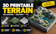
Do you want to turn a real-world location, mountain range, or heightmap into a 3D-printable terrain model?
I can help create 3D terrain models for physical printing, geographic displays, educational projects, landscape models, and terrain collections.
Whether you need a mountain range, hills, valleys, or terrain based on suitable elevation data, I will work with your requirements to create a model prepared for your intended use.
NOTE:
The quality of a real-world terrain model depends on the available elevation data and the level of detail it contains.
Please contact me before ordering if you need a specific geographic location, a particular print size, exaggerated terrain elevation, multiple connected terrain tiles, or a specialized printing workflow.
This service provides digital 3D model files. Physical printing and shipping are not included.
Let's turn your terrain idea into a 3D-printable model!
Please inform the freelancer of any preferences or concerns regarding the use of AI tools in the completion and/or delivery of your order.
3D Terrain Artist Landscape Modeling Heightmaps
Languages
What is a 3D-printable terrain model?
It is a three-dimensional representation of terrain designed to be manufactured using a 3D printer. Depending on the design, it may include mountains, valleys, elevation changes, and a base.
Can you create terrain from a real-world location?
Yes, when suitable elevation data is available and the project is within the agreed scope. Please provide the location and any specific geographic requirements before ordering.
Can you create terrain from a heightmap?
Yes, provided the heightmap is suitable for the intended terrain model. Resolution, elevation range, and file quality can affect the result.
Which file format will I receive?
STL is the primary format for this gig. Other formats may be available depending on the project and your requirements.
Will the model be ready for 3D printing?
The model will be prepared according to the selected package and agreed specifications. Printing requirements vary, so please share your printer, material, dimensions, and any special requirements in advance.
Can you add a solid base?
Yes, if requested and included in your selected package. Please provide your preferred base dimensions and thickness.
Can you exaggerate the terrain height?
Yes, within the limits of the project. Vertical exaggeration can make subtle geographic features easier to see, especially in small physical models.
Do you print and ship the physical model?
No. This gig is for digital 3D model files. Physical printing and shipping are not included.
