I will provide gis and spatial analysis services

A
ashanpradeep301
A
ashanpradeep301
Ashan Pradeep

About this gig

I am a B.Sc. (Hons) graduate in Surveying Science, specializing in Remote Sensing and GIS. I have 8+ years of experience in GIS mapping, spatial analysis, and remote sensing, delivering accurate geospatial solutions for real projects. I work with ArcGIS, ArcGIS Pro, ArcMap, QGIS, Google Earth Engine (GEE), Python, and Web GIS tools.

I provide GIS analysis, map creation, and geospatial data processing for engineers, researchers, planners, and businesses, with a focus on clear visualization and reliable results.

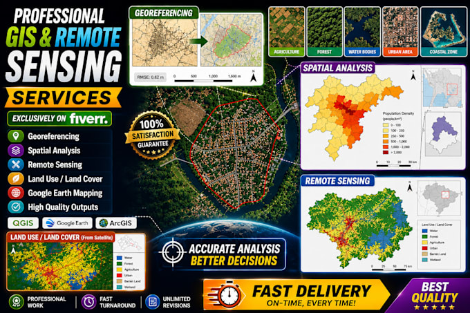
Services I Provide

  • GIS mapping and map creation
  • Spatial analysis and GIS analysis
  • Remote sensing and image processing
  • Land use and land cover mapping
  • Georeferencing, digitizing
  • Vector conversion and data collection
  • Web GIS and interactive web mapping (Leaflet, Mapbox, Google Maps API)
  • Cartography and visualization
  • Heatmap, network analysis
  • Hydrological and hydraulic analysis
  • Urban planning and landscape mapping
  • GIS database and geospatial data management
  • Google Earth and Google Earth Pro mapping
  • ArcGIS workflows

Why Choose Me

  • Accurate and high-quality results
  • Strong spatial and geospatial analysis skills
  • Clear map visualization
  • Reliable communication and delivery

Get to know Ashan Pradeep

Ashan Pradeep

Expert in GIS, Remote Sensing ,Autocad and Machine Learning , GIS Consultant

  • FromSri Lanka
  • Member sinceJun 2025
  • Avg. response time1 hour
  • Languages

    Sinhala, Tamil, English
I am a B.Sc. (Hons) graduate in Surveying Science, specializing in Remote Sensing and GIS, with over 8 years of experience in GIS mapping and geospatial analysis. I currently work as a GIS and Data Analyst at the International Water Management Institute (IWMI), delivering reliable geospatial solutions. Expertise: GIS mapping (ArcGIS Pro, ArcMap, QGIS), spatial analysis, remote sensing (GEE), Web GIS, georeferencing, digitizing, spatial databases, Python automation, and hydrology and urban analysis. I deliver accurate, clear, and high-quality GIS outputs tailored to your needs.

My Portfolio