I will perform spatial digitization and create maps and datas

A
ashmita_gis
A
ashmita_gis
Ashmita Rijal

About this gig

Are you looking for accurate GIS digitization and professional map preparation?

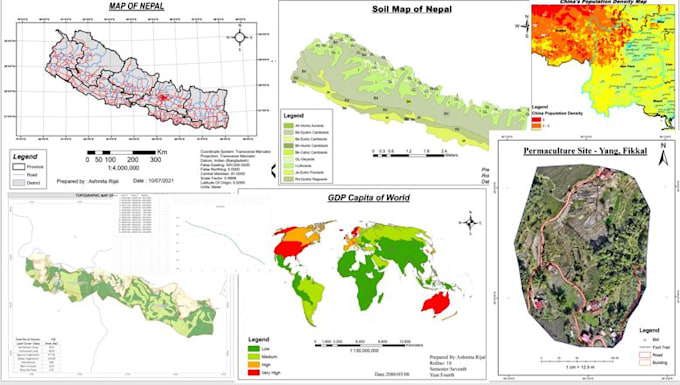
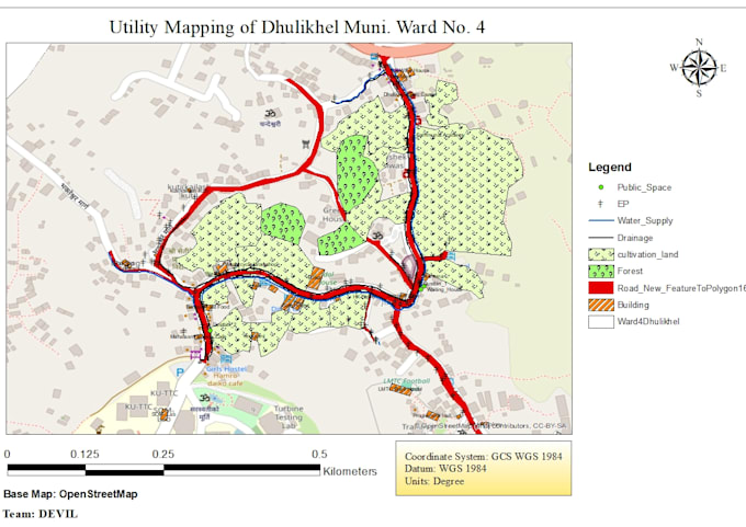
Hi, I'm Ashmita, a Geomatics Engineer specializing in GIS, Remote Sensing, and Cartography. I will digitize maps from satellite images, scanned drawings,given points or Google Earth and create clean, well-designed maps and spatial datas ready for reports, research, or presentations.

I ensure accuracy, proper projection, clean topology, and professional cartographic layout.

Services Include:

Digitization (points, lines, polygons)

Georeferencing

Map layout design

Thematic maps

Shapefile, GeoJSON, KML creation

PDF/PNG/JPEG outputs

Get to know Ashmita Rijal

Ashmita Rijal

Geomatics Engineer

  • FromNepal
  • Member sinceFeb 2026
  • Languages

    English
Hi, I’m Ashmita, a Geomatics Engineer specializing in GIS, Remote Sensing, GNSS, and Drone Mapping. I help researchers, companies, and organizations transform spatial data into meaningful maps, analysis, and professional reports. My expertise includes GIS Mapping, Spatial Analysis, LULC classification, Satellite Image Processing (Sentinel, Landsat, MODIS), Change Detection, Drone and GNSS data processing (RTK, PPK, Static). With a strong geospatial background and engineering foundation, I focus on accuracy, clarity, and professional results. Let’s turn your spatial data into powerful insights.