Browse categories
Explore
Fiverr Pro
English
$
USD


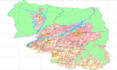
I will professionally digitize your maps, drawings, or satellite images into accurate GIS data formats such as Shapefiles, GeoJSON, or KML. Using industry-standard software like ArcGIS and QGIS, I will ensure precise vectorization, proper georeferencing, and clean attribute table creation. Whether you need to convert scanned maps, CAD files, or field sketches into usable GIS layers, I will deliver high-quality, ready-to-use datasets.
This service is ideal for urban planning, environmental studies, disaster management, land use mapping, and academic projects. With my expertise as a Geomatics Engineer, I guarantee accurate spatial data that meets professional standards. You can rely on me for timely delivery, clear communication, and results tailored to your specific requirements.
GIS Remote Sensing Google Earth Engine Python
Languages
