Hi and Welcome to my Gig!
Need accurate GIS layers from maps or satellite images?
I'll digitize your features in ArcGIS or QGIS to produce clean, ready-to-use vector data. With experience in GIS, remote sensing, and environmental mapping.
Services I Offer:
- Digitizing points, lines, or polygons from maps or satellite images
- Creating shapefiles, GeoJSON, or GeoPackage outputs
- Attribute table creation (with names, codes, or IDs)
- Layer organization and symbology for easy map use
- Coordinate system and projection setup (EPSG as per your need)
What You'll Receive:
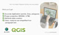
- Neat, topologically correct vector layers
- Correct projection (UTM, WGS84, etc.)
- Attribute data (if provided)
- Final files in your preferred format (SHP, GPKG, KML, or GeoJSON)
Why Choose Me:
- Skilled in ArcGIS, QGIS, and Google Earth Engine
- Detail-oriented and accurate mapping
- On-time delivery and professional communication
- Flexible: I handle both small and large mapping tasks
- I also welcome long-term collaborations and confidential projects.
I can customize packages to fit your needs. Please contact me before placing an order to discuss your project.
Cheers!
Ashwanie