Browse categories
Explore
Fiverr Pro
English
$
USD

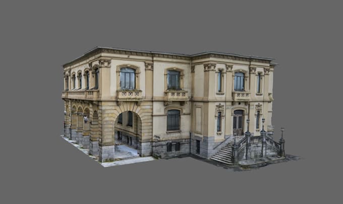
We will turn your existing 360° scans or photos into an interactive virtual tour or digital twin for real estate, construction progress monitoring, facility management, or heritage documentation.
Works with data from: Matterport, 3DVista, CloudPano, Kuula, iGUIDE, EyeSpy360, or raw 360° camera photos / laser scan data. If your scans are already hosted on one of these platforms, we can enhance, rebuild, or migrate them; if you just have raw photos or point cloud data, I build the tour from scratch.
Who benefits: Real Estate agents & property managers, architects & interior designers, construction/renovation teams needing progress documentation, facility managers, museums/heritage sites, hotels & venues.
What's included:
Background: Our team runs a professional surveying/3D-scanning practice, so this is daily technical work, not just tour editing.
Message us with your scan platform/format and space size before ordering so we can confirm scope and pricing larger or multi-site projects may need a custom quote.
Fiverr does not screen freelancers in this category. Please verify qualifications and discuss requirements with the freelancer before ordering, including any preferences regarding the use of AI tools.
Digital Engineering and Geospatial Solutions
Languages
Do I need a Matterport account, or can you use another platform?
Either works — We can build on Matterport, 3DVista, CloudPano, Kuula, or similar, or migrate/rebuild your tour on a different platform if you're moving away from one.
I don't have Matterport — can you still make a tour from my 360° photos or scan?
Yes, we can build a tour from raw 360° photos or point cloud/scan data without requiring any specific platform.
What's the difference between a Virtual Tour and a Digital Twin?
A virtual tour is primarily for viewing/navigation; a digital twin adds data layers, measurements, and is often kept updated over time for facility management or construction monitoring.
Who hosts the final tour?
Depends on platform — Matterport/CloudPano/etc. require their own hosting subscription; We can also deliver link on our hosted web version if you prefer minimal ongoing platform fees.
Can you add branding, floor plans, or embedded documents?
Yes, available in Standard/Premium packages.
