Browse categories
Explore
Fiverr Pro
English
$
USD


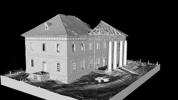
We will process your drone/UAV imagery into professional orthomosaics, digital elevation models, and textured 3D models ready for mapping, planning, construction monitoring, or visualization.
What's included:
Works with imagery from any drone/camera combination RGB or multispectral.
Formats delivered: GeoTIFF, LAS/LAZ, OBJ/FBX, or other on request.
Background: Our team runs a professional surveying and drone-mapping practice, so this is daily production work using industry-standard photogrammetry software (Pix4D/Agisoft Metashape).
Message us with your image count, flight altitude/overlap, and desired outputs before ordering so we can confirm the right package larger or more complex surveys may need a custom quote.
Digital Engineering and Geospatial Solutions
Languages
What drone/camera do I need?
Any drone with decent image overlap (70-80% front, 60-70% side) works — DJI, senseFly, fixed-wing, etc.
Do I need ground control points (GCPs)?
If your aim is to work on local coordinates then they are not strictly required, but they improve absolute accuracy so send them if available. On the other had if you need a specific coordinate reference system then you must include the ground control points file too.
What's the difference between DEM and DSM?
DEM (bare-earth terrain) vs. DSM (includes buildings/vegetation) — I can deliver either or both.
Can you process multispectral/NDVI imagery?
Yes, available as an add-on for agricultural/vegetation analysis.
My project has more images or a larger area than your packages cover — what do I do?
Message us with your image count and area size first, and we will send a Custom Offer with accurate pricing/delivery.