Browse categories
Explore
Fiverr Pro
English
$
USD

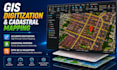
Need clean, accurate, and topology-error-free GIS data? Lets get it done right.
Poor spatial data integrity can ruin engineering, municipal, and real estate projects. With extensive experience handling large-scale digitization and strict corporate Quality Control (QC) protocols, I will vectorize, clean, and structure your geospatial data to perfection.
What I Offer: High Accuracy Digitization: Converting raster maps, blueprints, and Google Earth imagery into shapefiles, KML, or GeoJSON. Cadastral & Parcel Mapping: Creating precise land records, parcel boundaries, and structural datasets. Rigorous Quality Control (QC): Reviewing and fixing attribute errors, overlapping polygons, and gaps to ensure 100% spatial compliance. Network & Spatial Analysis: Proximity mapping and commercial network analysis for business development.
Deliverables: Clean Geodatabases (GDB), Shapefiles (SHP), KML/KMZ, or GeoJSON.
Fast turnaround and meticulous attention to detail guaranteed. Message me now to clean up your spatial data!
GIS and Remote Sensing Consultant
Languages


