I will create professional gis maps

A
ayazhangis
A
ayazhangis
Ayazhan K

About this gig

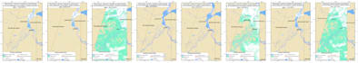
I am a GIS analyst specializing in environmental monitoring and satellite data analysis. I create clear, accurate and visually appealing maps for different purposes.

I can help you with:

-GIS maps (custom areas, regions, countries)

-Satellite data analysis (Google Earth Engine, remote sensing)

-Environmental monitoring (water, land, agriculture, etc.)

-Data visualization (clean and easy-to-read maps)

-Export in formats: PNG, GeoTIFF

Tools I use:

  • Google Earth Engine
  • QGIS / GIS tools
  • Satellite data (Sentinel, MODIS, etc.)

What you will get:

-High-quality map

-Accurate data representation

-Clean and professional design

-Fast communication

Important:

Please contact me before ordering to discuss your project details.

Get to know Ayazhan K

Ayazhan K

Hi,I'M GIS ANALYST

  • FromKazakhstan
  • Member sinceSep 2025
  • Avg. response time1 hour
  • Languages

    Russian, Kazakh, English
Hi! I’m a GIS Specialist with experience in spatial analysis, remote sensing, and cartographic design. I work with QGIS, ArcGIS, Google Earth Engine, and satellite data (Landsat, Sentinel) to deliver high-quality maps and analyses. I can help you with: Land use and land cover classification Crop and forest monitoring Spatial data visualization and mapping Geoprocessing and data analysis in QGIS/ArcGIS Custom map design for reports or presentations I always focus on accuracy, clear visualization, and timely delivery. Let’s turn your data into insights!