Browse categories
Explore
Fiverr Pro
English
$
USD


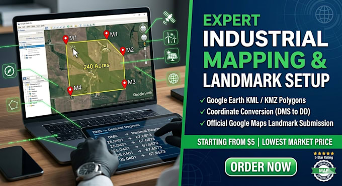
Are you looking to visualize your massive land project, solar/wind plant, or industrial facility on Google Earth and Google Maps? Most mapping services only focus on retail storefronts. I specialize in non-storefront infrastructure mapping, converting raw survey coordinates into highly accurate digital map assets. Whether its an energy plant, construction corridor, agricultural layout, or private property, I will plot it flawlessly.
️What I Can Do For You:
Information Gathering - You provide facility details, coordinates, photos
Verification - I verify accuracy against satellite imagery
Setup - Creation on Google Maps, Google Earth, and citation sites
Optimization - Category selection, description, service areas
Verification - Submission for Google verification (if applicable)
Documentation - Complete guide and access instructions
Types of Projects I Map:
Local SEO, Map Pack Optimization Specialist
Languages
Do you handle GMB verification?
Yes, I'll submit and guide you through verification. You'll receive the verification code/postcard.
Can you set up multiple locations?
Yes! I offer package deals for multi-location installations
What if my facility doesn't have a GMB yet?
Perfect - I'll create one from scratch and optimize it fully.
How long does verification take?
Google typically takes 3-7 days for location verification after submission.
Can I use satellite images?
Yes, but high-quality facility photos (if you can provide) work best for credibility.
| (1) | ||
| (0) | ||
| (0) | ||
| (0) | ||
| (0) |
khalidabdulla43

United States
Solved my issue quickly! Exactly what I needed..
Up to $50
Price
1 day
Duration
| (1) | ||
| (0) | ||
| (0) | ||
| (0) | ||
| (0) |
khalidabdulla43
United States
Solved my issue quickly! Exactly what I needed..
Up to $50
Price
1 day
Duration