Browse categories
Explore
Fiverr Pro
English
$
USD


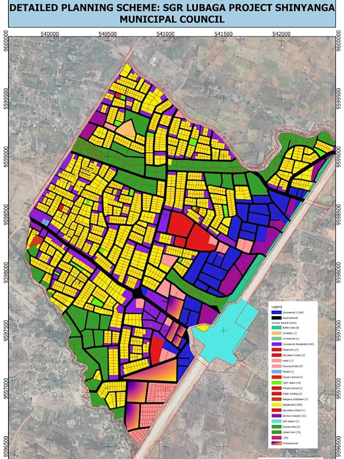
Welcome to my professional GIS and Town Planning services.
I am a skilled GIS expert and Town Planner with strong experience in spatial analysis, land subdivision and mapping using QGIS, ArcGIS and AutoCAD.
I can help you with:
What you will get:
Why choose me?
Please contact me before placing an order
Town planner
Languages
1. What information do you need to start the project?
I will need project details, shapefiles (if available), maps, coordinates, or any planning requirements related to your project
2. What GIS services do you offer?
I provide mapping, spatial analysis, digitizing, georeferencing, land use planning, and map design using QGIS and other GIS tools.
3. Can you work with my existing data?
Yes, I can work with your existing GIS data such as shapefiles, CAD files, satellite images, or survey data.
4. What format will I receive the final work in?
You will receive outputs in formats like PDF maps, shapefiles, GeoJSON, or any format you prefer.
5. Do you provide revisions?
Yes, I offer revisions to ensure the final work meets your requirements.
6. Can you help with urban/town planning projects?
Yes, I assist with land use planning, zoning maps, site analysis, and planning reports.
7. How long will the project take?
Delivery time depends on project complexity, but I always aim to deliver on time or earlier.