Browse categories
Explore
Fiverr Pro
English
$
USD

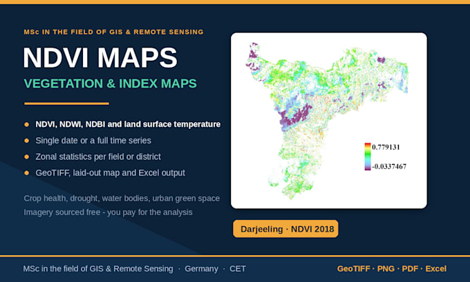
Turn free satellite imagery into the index maps your analysis needs: vegetation, water, built-up, burn severity or surface temperature.
Indices I produce: NDVI, EVI, SAVI (vegetation and crop health), NDWI, MNDWI (water bodies and moisture), NDBI (built-up area), Land Surface Temperature (LST) and urban heat island maps from Landsat thermal bands, and any other indices.
What I do: Source and pre-process the imagery, correct and cloud-mask it, compute the index, classify it into meaningful ranges, and lay out a clean map with a proper legend. For time-series work, I produce a dated sequence plus a chart of the values.
What you get:
Software: ArcGIS Pro, QGIS, SNAP
Satellite Mapping and Spatial Analysis, MSc in the field of Remote Sensing
Languages
Do I need to provide the satellite imagery or data?
No. Sentinel, Landsat and Copernicus DEM data are free and open, and I source them for you. If you already have imagery or a dataset, I will happily work with yours instead.
What software do you use, and can I open the files?
QGIS, ArcGIS Pro, and SNAP. Deliverables come as standard formats — GeoTIFF, shapefile, GeoPackage, GeoJSON, PNG, PDF, Excel — which open in any GIS. Editable project files are included in the Premium package.
Can you work in a specific coordinate system?
Yes. Tell me the EPSG code or the country/zone and I will deliver in it. If you are not sure, I will pick an appropriate projection for your study area and state it in the delivery.
