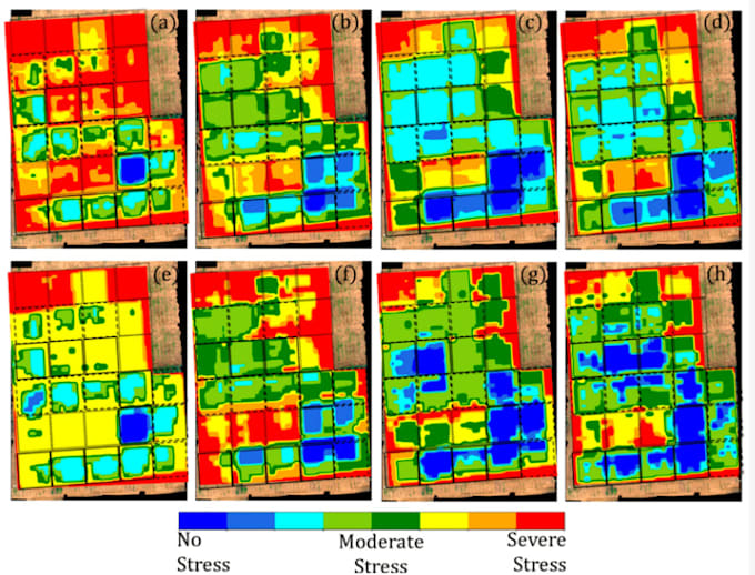
Are you concerned about the health and productivity of your crops? Understanding the stress levels of your crops early on can make a significant difference in yield and overall farm management. With advancements in technology, we now have the capability to monitor crop health remotely using drone or satellite imagery.
What I Offer:
- Precision Analysis: Utilize high-resolution drone or satellite images to accurately identify stressed areas within your fields.
- Timely Detection: Early detection of crop stress can lead to timely interventions, optimizing yield potential and reducing losses.
- Comprehensive Reports: Receive detailed reports with annotated images highlighting stressed areas, along with recommendations for remedial actions.
- Custom Solutions: Tailored solutions to fit your specific crop type, field size, and farming practices.
- Expertise: With years of experience in remote sensing and agriculture, I bring expertise to accurately interpret crop imagery.
- Efficiency: Fast turnaround times ensure you get the information you need when you need it most.
- Cost-effective: Save money by addressing issues before they escalate, leading to improved yields and profitability.