I will detect gold deposits using satellite imagery and ai remote sensing

B
bashar_moh1
B
bashar_moh1
Bashar

About this gig

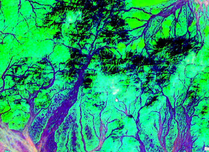
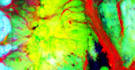
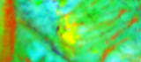
Expert Remote Sensing Specialist with 10+ years in gold deposit detection, now enhanced with Artificial Intelligence and Python scripting for automated analysis.

I combine advanced satellite imagery (ASTER, Landsat 8/9, Sentinel-1/2) with AI techniques to accurately identify gold-bearing alteration zones, iron oxides, hydroxyls, and structural features.

What I Offer:

  • Download and preprocess multispectral data
  • Traditional methods: PCA, Band Ratios, Fault extraction
  • AI enhancement: Python-based machine learning for anomaly classification and prospectivity modeling
  • High-potential zone prediction with greater accuracy
  • Detailed maps and reports with GPS coordinates

Proven success in Sudan, Saudi Arabia, Algeria, Mauritania analyzed 1,000+ images for mineral-rich regions.

Provide your area coordinates receive AI-powered prospectivity maps (GeoTIFF, Shapefiles, KMZ), interpretations, and actionable insights for efficient gold exploration.

Custom AI models available for recurring needs!

Get to know Bashar

Bashar
  • FromSaudi Arabia
  • Member sinceDec 2025
  • Avg. response time1 hour
  • Languages

    English, Arabic
Remote Sensing Specialist with over 15 years of hands-on experience in satellite image analysis for mineral exploration (gold, copper, platinum), archaeological site detection, and hydrocarbon prospecting. I download and process thousands of images from reliable sources using professional tools like ENVI, ArcGIS, QGIS, SNAP, and PCI Geomatica. Expertise in optical/SAR data, PCA, Band Ratio, fault line extraction, and creating high-accuracy prospecting maps.