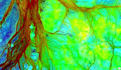
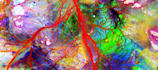
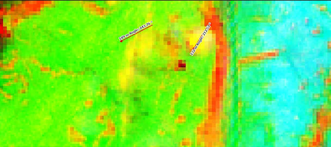
I will mineral exploration and gold detection using remote sensing

B
bashar_moh1
B
bashar_moh1
Bashar

About this gig

Expert Remote Sensing Specialist with 10+ years of experience in mineral exploration and gold detection using advanced satellite imagery analysis.

I specialize in identifying potential zones for gold, copper, iron oxides, and other minerals through multispectral and hyperspectral remote sensing techniques. Using professional tools like ENVI, ArcGIS, QGIS, SNAP, GAMMA, and PCI Geomatica, I process data from ASTER, Landsat 8/9, Sentinel-1/2, ALOS PALSAR.

Services I Provide:

  • Download and preprocess high-resolution satellite images
  • Principal Component Analysis (PCA) and Band Ratios for alteration mapping
  • Detection of iron oxides, hydroxyls, clay minerals, and hydrothermal zones
  • Fault/lineament extraction and anomaly detection
  • Creation of prospectivity maps highlighting high-potential areas
  • Data fusion from multiple sources and change detection
  • Detailed reports with GPS coordinates and interpretations

Successfully analyzed over 1,000 satellite images for projects in Saudi Arabia, Sudan, Algeria, and Mauritania. Proven accuracy in mineral-rich region prospecting.

Just provide the area coordinates or location I'll deliver professional maps (GeoTIFF, Shapefiles, KMZ), reports.

Get to know Bashar

Bashar
  • FromSaudi Arabia
  • Member sinceDec 2025
  • Avg. response time1 hour
  • Languages

    English, Arabic
Remote Sensing Specialist with over 15 years of hands-on experience in satellite image analysis for mineral exploration (gold, copper, platinum), archaeological site detection, and hydrocarbon prospecting. I download and process thousands of images from reliable sources using professional tools like ENVI, ArcGIS, QGIS, SNAP, and PCI Geomatica. Expertise in optical/SAR data, PCA, Band Ratio, fault line extraction, and creating high-accuracy prospecting maps.