I will convert any map, PDF, image or cad file to gis shapefile, kml, geojson

B
basharat_spsc
B
basharat_spsc
Basharat

About this gig

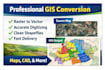
Are you looking to convert your maps, images, or data into accurate GIS shapefiles

You are in the right place

I am a professional GIS Analyst with strong experience in ArcGIS, QGIS, and spatial data processing. I will convert your data into clean, well structured GIS formats for analysis, mapping, or web use

Services I Offer

  • Convert PDF, image, sketch, or scanned map to shapefile
  • Convert Google Maps or satellite data into GIS layers
  • KML, KMZ, GeoJSON, CSV to shapefile conversion
  • Georeferencing raster images
  • Digitizing roads, buildings, boundaries, and utilities
  • Attribute table creation and data cleaning

Output Formats

  • Shapefile shp
  • GeoJSON
  • KML or KMZ
  • File Geodatabase

Why Choose Me

  • High accuracy and clean topology
  • Fast delivery
  • Professional GIS standards
  • 100 percent client satisfaction

Please contact me before placing an order to discuss your project

Let us turn your map into powerful GIS data

Get to know Basharat

Basharat

GIS and RS Analyst Python Google Earth Engine Arcpro Qgis

5.0(9)
  • FromPakistan
  • Member sinceJun 2023
  • Avg. response time1 hour
  • Last delivery2 years
  • Languages

    Urdu, English
"🌐 GIS & Remote Sensing Specialist 🛰️ 🔍 Over 7 years of academic and professional expertise 🗺️ Specialized in geospatial analysis, mapping, and remote sensing 🛠️ Proficient in: ArcMap Python Google Earth Engine Google Earth Pro Can provide High-resolution satellite imagery 💡 Full command over GIS/RS tools with efficient handling of Raster and Vector data. Let's collaborate to turn your spatial data into actionable insights and create stunning geospatial solutions. Your projects, my skills – let's make it happen!"

My Portfolio

Other Data Visualization Services I Offer