Browse categories
Explore
Fiverr Pro
English
$
USD

Level 1
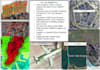

Welcome to your go-to place for all things Google Earth! I am a skilled professional ready to bring your geographical visions to life. Whether you need intricate polygons, precise lines, or captivating animated tours, I've got you covered.
Here are the services
I offer:
I can draw polygons, lines in various shapes and sizes in Google Earth.
I will assist you in any task related to Google Earth creating
of kmz, kml
Conversion of file to any formats,
Digitizing (points, Lines, Polygons)
Satellite imagery
Zoom in tour,
Pin point tour without after effect
Google earth tour,
Are you in need of
accurate and detailed satellite imagery for your specific area of interest?
Look no further! I offer a comprehensive service utilizing Landsat, Sentinel,
and high-resolution satellite imagery.
Sentinel Data: Moderate Resolution 20m Pan-sharpening 10m
High Resolution Data up to 0.3m for Digitization or cadastral mapping
Landsat Data: Course Resolution 30m Pan-sharpening 15m
Let's turn your geographic ideas into reality! Contact me now to discuss your project and get started on a journey through Google Earth l
GIS and RS Analyst Python Google Earth Engine Arcpro Qgis
Level 1
Languages
Can I specify a custom area of interest for the satellite imagery analysis?
Absolutely! You can provide the details of your desired location, and I will clip the imagery accordingly to focus on the specific areas that matter most to you.
What is pan-sharpening, and why is it important?
Pan-sharpening is a process that enhances the spatial resolution of satellite imagery by fusing high-resolution panchromatic data with lower-resolution multispectral data.
What deliverables can I expect from the service?
You will receive a comprehensive package of processed imagery tailored to your specifications. Deliverables may include georeferenced images, vegetation indices, and other outputs based on your specific requirements.
What file formats can you work with for conversions?
I can handle a wide range of file formats for conversions, ensuring compatibility with Google Earth. Feel free to share your specific format, and I'll assist you accordingly.
What information do you need for a KMZ or KML creation?
To create a KMZ or KML file, I'll need details about the specific elements you want to include, such as points, lines, or polygons. Additionally, any specific styling preferences or additional information would be helpful.
| (1) | ||
| (0) | ||
| (0) | ||
| (0) | ||
| (0) |

biotaurus

Netherlands
thank you.
$50
Price
4 days
Duration
| (1) | ||
| (0) | ||
| (0) | ||
| (0) | ||
| (0) |
biotaurus
Netherlands
thank you.
$50
Price
4 days
Duration