Browse categories
Explore
Fiverr Pro
English
$
USD
GIS Analyst, Civil Engineer, CAD, Civil 3D, ETABS, BIM, Adobe Premiere Pro
Most GIS gigs stop at a pretty map on a pdf. I make it with the engineering behind it if required.
I run complete disaster risk assessments; most
recently I did a full analysis for Tsho Rolpa Glacial Lake, Nepal, covering DEM processing,
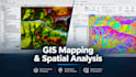
geotechnical slope stability of moraine dam present there, and HEC-RAS 2D flood simulation across 3 breach scenarios. I've also mapped a real flood event that occurred in Rasuwa district of Nepal from raw satellite imagery within days of it happening.
What I do:
and other GIS works.
Clean exports:
shapefiles, Geo TIFFs, dwg files and other extensions as per needed
Who this is for: engineering consultancies, disaster-risk NGOs, researchers,
and planners who need spatial analysis they can actually build on not
just a picture.
Every processing step and assumption is documented. Send me your AOI and
what you need, and I'll tell you directly which package fits and how long
it'll take.

Do you need site survey data, or can you work with public data only?
Public data also works fine, I primarily use CopDEM-GLO30 and other open elevation/satellite sources. Send survey data for more precision and accuracy if available along with instructions and I will work within those information.
What area size does the Basic package cover?
Send your AOI first and then I'll confirm scope and turnaround before you order; this keeps pricing fair for both of us.
Can you match my country's flood-modeling or engineering standards?
Tell me the standard/code you need followed and I'll confirm before starting.
Do you offer revisions or extra scenarios?
Revisions per package are listed above; additional scenario reruns can be added as a paid extra. It is flexible.
What file formats do you deliver?
Any to sum it up; ArcGIS Pro project files, shapefiles, Geo TIFFs, and a PDF report as standard; AutoCAD/DWG exports available too.
