Browse categories
Explore
Fiverr Pro
English
$
USD

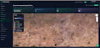

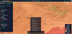
I will build a professional interactive WebGIS application using React, OpenLayers/MapLibre, and PostgreSQL/PostGIS the same stack behind BioAtlasDZ and institutional coastal GIS portals (GIZ, CNL).
What you get:
Responsive web map with WMS/WFS layers, popups, filters, and legends
Geospatial search, draw/measure tools, and export (PNG/PDF/GeoJSON)
Clean React/TypeScript frontend + API backend
PostGIS database design and data import (Shapefile, GeoJSON, CSV)
Optional GeoServer publishing and VPS deployment
Ideal for: environmental dashboards, parcel tracking, biodiversity atlases, insurance geoportals, municipal GIS portals.
Live references: bioatlasdz.com · app.geochainlabs.com
Stack: React 19 · TypeScript · OpenLayers · FastAPI/Node.js · PostGIS · GeoServer · Nginx
Message me your data format, use case, and timeline I respond quickly with a clear delivery plan.
Please be aware that it is against Fiverr's policies for sellers to include themes, templates, or any other elements that infringe third-party rights or applicable laws in the delivered work. Read more about in our Guide to Responsible Digital Creation.
Geomatician and full stack developper
Languages
Do you provide the geospatial data?
Yes. I can structure and import your Shapefile, GeoJSON, KML, or PostGIS dump. If you need data collection, ask for a custom offer.
Can you integrate satellite imagery?
Yes — Sentinel, Google Earth Engine, or WMS tile services can be integrated into the map.
Do you offer post-delivery support?
Yes. 30 days of bug-fix support included on Premium; extended maintenance available.


