Browse categories
Explore
Fiverr Pro
English
$
USD


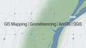
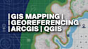
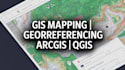
Are you looking for a professional GIS expert to handle your georeferencing, GIS mapping, spatial analysis, or map digitization tasks?
I provide accurate and high-quality geospatial services using industry-standard tools like ArcGIS and QGIS to help you manage, analyze, and visualize spatial data effectively.
Services I Offer:
Tools I Use:
Why Choose Me:
Kindly contact me before placing an order to discuss your project requirements.
GIS Geospatial Analysis Spartial
Languages
Q1: What files do you support?
I support formats such as PDF, JPG, PNG, TIFF, shapefiles, KML, CSV, and Excel files.
Q2: What software do you use for GIS tasks?
I use ArcGIS, ArcGIS Pro, QGIS, Google Earth, and other geospatial tools.
Q3: Can you digitize maps into shapefiles?
Yes, I can convert raster maps into vector formats and deliver shapefiles.
Q4: Do you provide georeferencing for scanned maps?
Yes, I provide accurate georeferencing for scanned maps, images, and PDFs.
Q5: Can you perform spatial analysis?
Yes, I can perform spatial and geospatial analysis depending on your project requirements.
Q6: Do you offer data extraction or scraping services?
Yes, I can assist with web scraping, data extraction, and data collection tasks using Python and related tools.
Q7: Can I request custom GIS projects?
Yes, feel free to contact me with your project details and I will provide a custom solution.