Browse categories
Explore
Fiverr Pro
English
$
USD

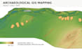
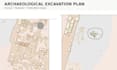
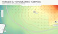
I create professional archaeological and scientific GIS maps using QGIS. My work is suitable for archaeological reports, research papers, theses, presentations, and field projects.
I can work with your spatial data, coordinates, survey points, historical maps, excavation plans, DEMs, and other archaeological datasets. Services may include georeferencing, digitization, coordinate and CRS processing, terrain and contour mapping, site distribution maps, and publication-ready cartographic layouts.
You will receive a clear, accurate, and professionally designed map in high-resolution PDF, PNG, or JPG format. For advanced projects, I can also provide editable GIS files.
Please contact me before ordering if your project involves complex georeferencing, survey data, DEM processing, or multiple datasets.
Archaeological Mapping, GIS Specialist
Languages


