Browse categories
English
$
USD
Connect to your AI



HELLO AND WELCOME TO MY GIG
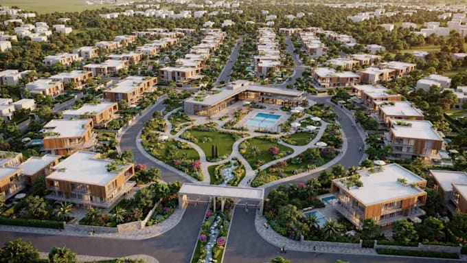
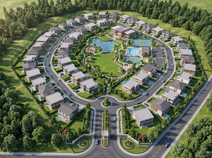
I create professional 3D subdivision plans, plot layouts, parcel arrangements and land development masterplans for residential and real estate projects.
Whether you are planning a residential subdivision, organizing individual land plots or visualizing a new housing community, I can help transform your site information into a clear, detailed and visually appealing 3D presentation.
My services include:
What you will receive:
NOTE; Please contact me before ordering if your project involves a large site or complex development.
Please inform the freelancer of any preferences or concerns regarding the use of AI tools in the completion and/or delivery of your order.
3D Visualization and Modeling Specialist
Languages
Q1. What is a 3D subdivision plan?
A 3D subdivision plan visually presents how a property can be organized into individual plots, roads, green spaces and other development features.
Q2. Can you design residential subdivision masterplans?
Yes. I provide conceptual 3D visualization of residential subdivisions, housing communities and land-development layouts.
Q3. Can you work with my existing site plan?
Yes. You can provide an existing site plan, survey drawing, sketch or other project reference as the basis for visualization.
Q4. Can you include roads, parks and green spaces?
Yes. These can be included according to your supplied layout and project requirements.
Q5. Can you create layouts with more than 50 plots?
Yes. Larger projects can be discussed through a custom offer based on the number of lots, site complexity and required views.
Q6. Do you provide editable source files?
Editable files may be available depending on the software and project scope. Please confirm before ordering.
Q7. Do you provide certified land surveying or legally approved plans?
No. This service is for conceptual visualization and presentation. It does not replace professional surveying, engineering or legally approved documentation.
Q8. Can I request a custom design?
Yes. Contact me with your project information and I can discuss a suitable scope and custom offer.