Browse categories
Explore
Fiverr Pro
English
$
USD

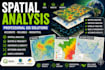

I provide professional GIS spatial analysis and geoprocessing services using QGIS, ArcGIS and remote sensing techniques.
Services include:
I deliver organized, accurate and high-quality GIS products for academic, environmental and technical projects.
Professional layouts, reliable analysis and fast communication.
Please inform the freelancer of any preferences or concerns regarding the use of AI tools in the completion and/or delivery of your order.
Civil Engineer
Languages
Do you work with QGIS and ArcGIS?
Yes. I work with QGIS, ArcGIS and GIS geoprocessing tools.
Can you perform raster and vector analysis?
Yes. I work with raster, vector and remote sensing analysis.
Which outputs do you deliver?
PDF, PNG, shapefiles, KML/KMZ and GIS source files.
Can I send my own GIS data?
Yes. You can send shapefiles, rasters, coordinates or reference data.


