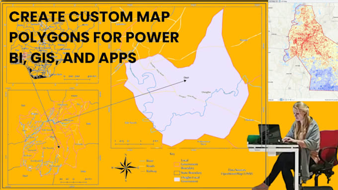
I will create custom map polygons for power bi, gis, and apps

C
charlotteyellow
C
charlotteyellow
charlotte

About this gig

Custom GIS Polygons, GeoJSON & Mapping Services

Need custom map boundaries for your dashboard, GIS project, or application? I create accurate, lightweight polygons ready for mapping, analysis, and visualization.

Services

  • Custom polygon creation
  • GeoJSON development
  • KML and Shapefile generation
  • Boundary digitization
  • Administrative and zoning maps
  • Delivery and service area mapping
  • Geofencing polygons
  • Map data conversion
  • Geometry optimization
  • GIS data preparation

Supported Platforms

  • Power BI
  • Tableau
  • ArcGIS
  • QGIS
  • Mapbox
  • Leaflet
  • OpenLayers

Deliverables

  • GeoJSON
  • KML
  • SHP
  • CSV
  • Other GIS formats upon request

Polygons can be created from coordinates, sketches, satellite imagery, or reference maps and optimized for fast loading and smooth performance.

Please contact me before placing an order to discuss your project requirements and preferred output format.

Get to know charlotte

charlotte

GIS, Remote Sensing and Data Automation Specialist

  • FromUnited States
  • Member sinceMay 2026
  • Avg. response time2 days
  • Languages

    English
An experienced professional with expertise in GIS, remote sensing, workflow automation, and geospatial data engineering. I specialize in GIS mapping, spatial data analysis, CAD-to-GIS conversion, satellite image processing, cartography, BIM modeling, and data analytics. Proficient in automation using FME and Python, I help streamline workflows and improve operational efficiency. I also provide graphic design, CAD services, and Excel-based data analysis. Committed to delivering accurate, high-quality, and timely solutions tailored to client requirements.