Browse categories
Explore
Fiverr Pro
English
$
USD
China
1 order completed
Custom GIS Maps, Dashboards, Predictive Models
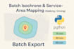
I create professional isochrone maps (travel time areas) for businesses, real estate, transport planning, and location analysis.
Isochrones show how far you can travel within a certain timefor example:
What you receive:
Isochrone polygons (GeoJSON, SHP, or PNG)
Travel-time heatmaps
Catchment analysis
Custom colors & styles
Mapbox / OSM-based processing
You can combine this with geocoding or distance analysis for a complete report.

Technology:
Excel
•
Python
Expertise:
API integration
What is an isochrone?
It shows areas reachable within X minutes from a point.
Can you calculate both walk and drive time?
Yes, driving, walking, cycling (if supported by data).
Can you analyze multiple locations?
Yes, choose Standard or Premium.
