Browse categories
Explore
Fiverr Pro
English
$
USD



I will georeference and digitize your site plans, maps, and PDFs into GIS
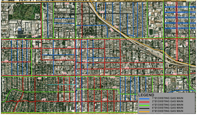
Turn your scanned maps, PDF site plans, or image sketches into accurate, ready-to-use GIS shapefiles or CAD-ready formats. As a Georeferencing Expert, I ensure your drawings are perfectly aligned to real-world coordinates for precise planning and analysis.
Ideal for converting old surveys, architectural PDFs, or hand-drawn plots into digital, scalable formats.
My services include:
High-Precision Georeferencing of maps, images, and PDFs
Digitization of points, lines, and polygons (property boundaries, roads, contours)
PDF/Image/JPG to Shapefile or KML Conversion
CAD to GIS / GIS to CAD Data Conversion
Attribute Data Entry & Organization
Why work with me?
Send me your scanned file, and I'll deliver a georeferenced, digitized map ready for your next step.
ArcGIS Expert and Mapping and Analysis
Languages
What file types can you georeference and digitize?
I can work with scanned images, PDFs, JPG/PNG photos, AutoCAD DWG/DXF files, and even hand-drawn sketches. The clearer the source file, the more accurate the result.
How accurate will my georeferenced file be?
Accuracy depends on the quality and scale of your source document and the control points available. I use professional techniques in ArcGIS to achieve the highest possible accuracy. For best results, please provide known coordinate points or a reference map if available.
What deliverables will I receive?
You will receive the georeferenced image (e.g., .tif) and the digitized vector files in your chosen format (e.g., Shapefile .shp, KML, DWG) along with the associated files. All standard GIS/CAD formats are supported.
I have many maps to process. Do you offer bulk discounts?
Yes, I offer special rates for bulk projects. Please contact me before ordering to discuss the scope and get a custom offer.
Can you add attribute information (like names, areas) to the digitized features?
Yes, data entry and attribute assignment are core parts of the digitization service, especially in the Standard and Premium packages.
| (1) | ||
| (0) | ||
| (0) | ||
| (0) | ||
| (0) |
rcanderson85

United States
Made many changes for me on a project and made sure I was happy with the results
$50-$100
Price
2 days
Duration

Seller's Response
| (1) | ||
| (0) | ||
| (0) | ||
| (0) | ||
| (0) |
rcanderson85
United States
Made many changes for me on a project and made sure I was happy with the results
$50-$100
Price
2 days
Duration
Seller's Response