I will do gis and remote sensing research and comprehensive data analysis

C
chrisspinks240
C
chrisspinks240
Chriss S

About this gig

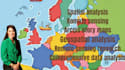
Are you looking for professional help in GIS and remote sensing research along with thorough spatial data analysis? I provide high-quality geospatial services, turning raw spatial and satellite data into actionable insights for research, environmental studies, urban planning, and business projects.

With expertise in GIS, remote sensing, and spatial analysis, I ensure accurate mapping, analysis, and interpretation of your data for informed decision-making.

Services I Offer:

  • GIS and remote sensing data processing and analysis
  • Spatial analysis and modeling
  • Satellite imagery interpretation and classification
  • Land use and land cover mapping
  • Thematic, topographic, and interactive GIS maps
  • Multi-layer geospatial data integration
  • Comprehensive research reports and documentation

Tools & Software:

  • ArcGIS & QGIS
  • Google Earth Engine
  • ENVI & ERDAS Imagine
  • Remote sensing and GIS analysis tools

Why Choose Me?

  • Expert analysis with accurate results
  • Clear, well-documented reports
  • Professional and high-quality GIS outputs
  • On-time delivery and excellent communication

Please contact me before placing an order to discuss your project requirements in detail.

Get to know Chriss S

Chriss S
  • FromUnited States
  • Member sinceOct 2025
  • Languages

    English
I am specialized in professional writing crafting, revising, and editing reports, proposals, and technical content with precision. My expertise also spans GIS and spatial analysis, allowing me to combine strong communication skills with deep technical insight. I’m committed to delivering clear, polished, and impactful results.