I offer a wide range of GIS services tailored to your needs using QGIS and ArcGIS.
Services include:
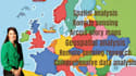
- Mapping: High-quality thematic, interactive, and 3D maps.
- Spatial Analysis: Suitability modeling, network analysis, and proximity studies.
- Remote Sensing: Land cover classification, NDVI, and change detection.
- GIS Programming: Python scripting, geospatial tool automation, and API integration.
- Custom Tools: Developing plugins and models for data processing and analysis.
- Geoprocessing: Clipping, merging, geocoding, and re-projection.
- Data Management: Cleaning, digitizing, and spatial database setup.
- Visualization: Story maps, dashboards, and data-driven charts.
Message me to discuss your needs or place your order now to get started.